


(Canadian Hurricane Centre)
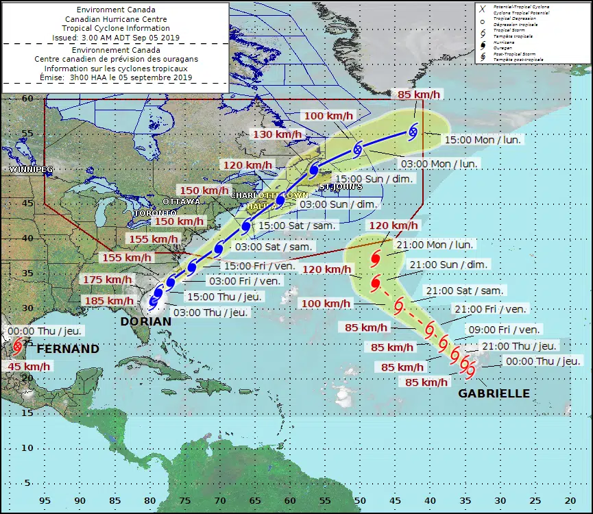
Hurricane Dorian is expected to severely impact parts of the Atlantic provinces this weekend.
Particularly Shelburne and Lunenburg counties.
It’s currently located approximately 178 kilometres south of Charleston, South Carolina with maximum sustained winds: 185 kilometres an hour.
The Canadian Hurricane Centre says, based on the latest forecast guidance, the most likely track projection brings Hurricane Dorian south of the Maritimes on Saturday, pushing through eastern Nova Scotia late in the day.
It says most regions will experience some tropical storm force winds. Near and to the south of the forecast track, winds should reach hurricane force. As the storm moves across Nova Scotia, there is a possibility of hurricane force northwesterlies behind it.
Rainfall will be significant with widespread amounts in excess of 50 mm, but north and west of Dorian, a swath of more than 100 mm is likely.
Large waves will reach the southwestern shore of Nova Scotia on Saturday and build to near 10 metres over the eastern shore Saturday night.
The storm is expected to move through our region quickly with better weather forecast for Sunday.